Package 1
🗺️
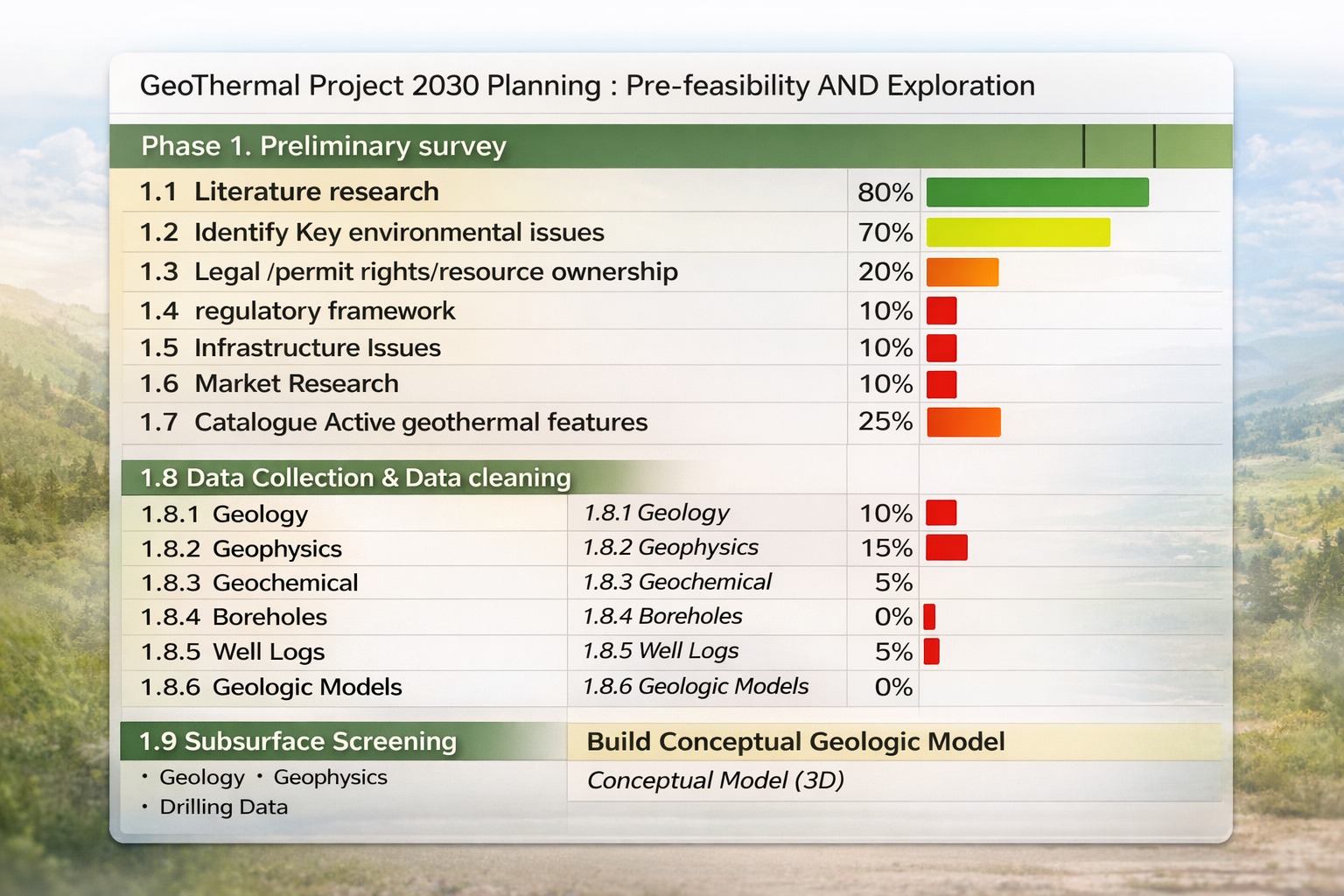
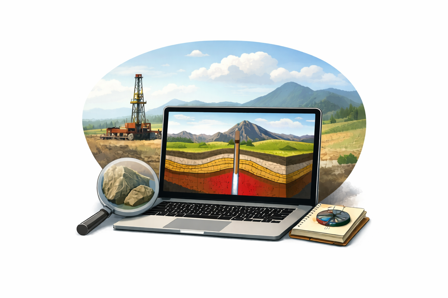
Desktop heat potential scan
Is this area worth exploring further?
- Temperature–depth and gradient estimates
- Reservoir concept and structural setting (high-level)
- Traffic-light summary: go / watch / drop
We combine geoscience, GIS, satellite imagery and AI workflows to screen your area for geothermal potential — remotely, globally, and with decision-ready clarity.
Choose the level of detail you need — from rapid screening to investor-ready pre-feasibility.
Is this area worth exploring further?
Can geothermal realistically serve your heat users?
Independent due diligence for boards, funds and utilities.
A simple three-step workflow from polygon to decision-ready insight.
Draw a polygon (or share coordinates/licence boundary) and your key questions.
We combine public/proprietary datasets with AI workflows and expert review.
A short PDF with maps, risks, potential ranges, and suggested next steps.
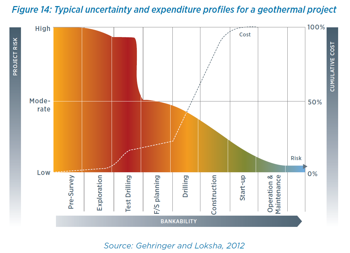
We support the full pre-feasibility phase — from desktop geology to policy, permitting and subsidy scouting — so you can move from idea to drill-ready plan with confidence.
The same workflow supports very different actors — from single landowners to cities, utilities, and investors.
See if geothermal development could work on your land and what partnership model makes sense.
Standardised early-stage scans to prioritise acreage, licences and leads before major spend.
Identify geothermal zones, compare against alternatives and support long-term planning decisions.
Independent early-stage reviews: potential ranges, key risks, and what evidence is needed before capital deployment.
Support zoning, permitting context, subsidy scouting, and prioritising geothermal opportunities with transparent assumptions.
Use our map-based scan tool to draw a polygon for your area of interest and begin the screening workflow instantly.
Open the map & draw a polygon ↗Share your area of interest and we’ll respond with a short proposal, timeline and example output.
Start your geothermal feasibility scan →